
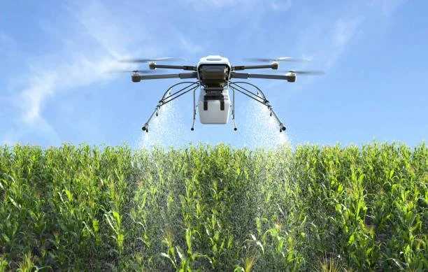
Why Drone Application?
Smarter application. Better Stewardship. Greater Precision.
Modern agriculture demands more than simply applying crop protection products—it requires making every application count. Drone application combines precision technology with agronomic best practices to help farmers maximize efficiency, protect their crops, and reduce unnecessary inputs.
At Jay-Bird's Precision Ag, we use drone technology to place products where they're needed, when they're needed, with minimal impact on your crop and soil.
Why Choose Drone Application?
Reduce Crop Damage
Traditional ground sprayers can create wheel tracks that damage crops, particularly during late-season applications. Drone application eliminates wheel traffic, helping preserve yield potential while allowing applications later in the growing season when traditional equipment may cause unnecessary damage.
Minimize Soil Compaction
Heavy application equipment can compact soil, reducing root development, water infiltration, and long-term productivity. Because drones never enter the field, your soil structure remains undisturbed.
Apply When Fields Are Too Wet
After rainfall, waiting for fields to dry can delay critical applications. Drones allow treatments to continue without risking equipment getting stuck or damaging saturated fields. This can be especially important during narrow fungicide or insecticide application windows.
Precision Where It Matters
Every acre doesn't always require the same treatment. Drone technology allows for highly accurate applications that can target specific areas of concern while reducing unnecessary overlap and waste. Benefits include:
Reduced chemical use
Improved application accuracy
Better coverage
Reduced overlap
Improved efficiency
Better Environmental Stewardship
Precision application helps protect both your investment and the environment. By reducing unnecessary applications and limiting drift potential, drone spraying supports responsible nutrient and pesticide management while helping protect neighboring crops, waterways, pollinators, and sensitive areas.
Access Difficult Areas
Drone application is ideal for areas that are difficult or impractical for traditional equipment, including:
Small fields
Irregular field shapes
Steep terrain
Wet ground
Field edges
Areas surrounding waterways
Sensitive conservation areas
Precision Agriculture Services
Drone application is only one part of precision farming. Jay-Bird's Precision Ag also provides aerial data and field analysis to help growers make informed management decisions.
Prescription Mapping
Variable-rate management starts with accurate information. Using aerial imagery and field analysis, we can develop prescription maps that identify field variability and support site-specific management decisions. Prescription maps may be used for:
Variable-rate fertilizer applications
Variable-rate seeding
Variable-rate lime applications
Targeted crop management
Improving input efficiency
Prescription files can be exported for compatibility with many modern precision agriculture platforms and equipment.
Crop Scouting
High-resolution aerial imagery provides another perspective on crop health. Drone scouting can help identify:
Nutrient deficiencies
Disease pressure
Insect damage
Weed escapes
Emergence issues
Stand establishment problems
Drainage concerns
Storm damage
Early detection allows problems to be evaluated sooner, helping improve management decisions throughout the season.
Stand Counts & Emergence Evaluation
Accurate stand establishment is critical for maximizing yield potential. Drone imagery can assist with:
Plant population estimation
Emergence uniformity
Replant decisions
Early-season field evaluation
Field Mapping
Detailed aerial mapping provides valuable information for planning and recordkeeping
Available mapping services include:
Orthomosaic maps
Field boundary mapping
Acreage verification
High-resolution aerial imagery
Elevation and terrain visualization (where appropriate)
Variable-Rate Planning
No two fields are identical. Combining aerial imagery with agronomic information helps identify variability across a field and supports more informed management decisions. Variable-rate planning can help:
Optimize fertilizer placement
Improve nutrient efficiency
Reduce unnecessary input costs
Support sustainable production practices
Why Work With Jay-Bird's Precision Ag?
Technology alone doesn't improve yields—good decisions do. Our goal is to combine modern drone technology with practical agronomic knowledge to deliver solutions that improve efficiency, reduce unnecessary costs, and support long-term farm profitability. Every recommendation is made with your operation in mind. If drone application isn't the best solution for your field, we'll tell you. Building long-term relationships through honesty, professionalism, and dependable service is more important than making a sale.